
Taaiboschkraal : “tough bush corral” [Ned]; the first farm on the left in the Clanwilliam Boskloof, ascending the kloof from north to south
Taaiboskraal : “tough bush corral” [Afr]; a Rocklands bouldering site south of Soldaatskop, off the Pakhuis Pass
Taaiboskraalrivier : “tough bush corral river” [Afr]; a considerable tributary of the Jan Dissels River that runs down from Amon se Poort past Taaiboschkraal farm
Taaibosrug : “tough bush ridge” [Afr]; 1. a ridge in the Tra-Tra mountains that runs north-south, east of the Wupperthal road at Sandwerf; 2. a subsistence farm of the same name, situated on Taaibosrug
 |
| The iconic Tafelberg: photo by Graham Bellairs |
Tandekop : “teeth hill” [Afr]; a 644m hill in the Pakhuisberge, a few kilometres due north of Spitskop
 |
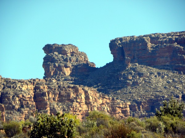
| Tandjiesberg, from the Kerskop Pass |
Tangela : a ruined and abandoned farm west of the N7 and north of Mon Desir; the origin is unknown, although Tangela is a Pokemon character whose face is obscured by blue vines (???)
 |
| Tant Dollie se Huis; photo from Hebron website |
 |
| Tarakamma in springtime |
Tea Lady : a bouldering site near Klein-Kliphuis farm, probably so-called because there is a tea room at the farm; in 2013 there was some controversy over the use of this site for bouldering – it is on private land
Teardrop Dam : a teardrop-shaped dam on the Bushmans Kloof reserve
Teekliphuis : “tea stone house” [Afr]; a farm north of Klipopmekaar, in the Pakhuisberge
Teekop : “tea hill” [Afr]; an 1133m peak north east of Langkop and west of The Dome
Tentstokkloof : “tent pole ravine” [Afr]; an intriguing name; the ravine through which runs the Suurvleirivier, between Zuurvlakte and Boffelshoek in the southern Cederberg
 |
| The Anvil |
The Baths : a resort in the Olifants River mountains south of Citrusdal, famous for its hot springs, which have been in use since the earliest travellers passed that way. The first pass over those mountains into the Olifants River valley, the ‘Cardouw’ or ‘narrow pass’ [Khoi], was nearby
 |
| The Camel; photo by Ken Howes-Howell, 1952 |
 |
| The Dome from Five Ways View, with the Boskloof Pinnacle behind |
The Football Field : a high restioid flat on the western side of the summit of Apollo Peak
The Hump : a hillock of about 1390m south west of The Camel, see above
 |
| The Knobless Robot, in the Adderley Street crack |
The Maze : an area of extremely broken rock and huge boulders on the high eastern slopes of the Skerpioensberg, where, by repute, at least one forester disappeared, never to be seen again
 |
| View towards Kromrivier from The Pup; photo by Graham Bellairs |
The Snout : The south eastern point of The Pup is known as The Snout
 |
| The Spout; photo by Graham Bellairs |
The Twins : see Twin Rocks below
 |
| Three Stones: don’t lose the path here! |
 |
| Tielman Roos; photographer and (rather kind) cartoonist unknown |
Tielman Roos se Kop : “Tielman Roos’s peak” [Afr]; a 1483m peak between Protea and Algeria Peaks in the central Cederberg; see above
Tierbank : “tiger (=leopard) bank” [Afr]; a small, stony ridge between the Katstertrivier and its tributary that runs parallel to it, a few hundred metres to its west; both south of Kleinvlei. Leopards have been incorrectly referred to as ‘tigers’ since the earliest days of Dutch settlement at the Cape – cf the Tygerberg hills near Cape Town, so called because the pattern of old termite mounds upon them give them a spotted appearance, like a leopard (and not striped, like a tiger!). See Cape Leopard Trust above
Tierhoek : “tiger (=leopard) corner” [Afr]; the valley or ravine behind Die Toring in the Clanwilliam Boskloof through which the Klip River runs, and where there are the ruins of an old subsistence farm of the same name
 |
| The gorgeous Tierhoek Falls |
 |
| The Tierhok in Cederhoutkloof |
Tierhoksberg : “tiger (=leopard) trap mountain” [Afr]; a 1410m peak in the Grootberge, due east of Langkloof and west of Bakkrans
 |
| The Tierkloof gum tree near Kleinvlei |
 |
| Tolklip near Boontjieskloof |
Tom se Gat : “Tom’s hole” [Afr]; a pool in the Rondegat River just north of the Meidedrif, on Jamaka farm; Tom was a local forestry worker
 |
| Arctotis acaulis: the tonteldoek daisy |
 |
| Tonteldoekkloof, seen from Uitskietdrif |
 |
| The Tool Tree near Grasvlei |
Topdrift : “upper drift”; a farm south of the R303, between Allandale and the Elandskloof turn off
Toppie se Berg : “Toppie’s Mountain” [Afr]; a mountain with three peaklets of 834m, 875m and 906m north of the R303 and opposite Topdrift farm; it seems probable that Toppie and Top are the same name of an unknown person
 |
| The TraTra mountains north of Wupperthal, with Citadel Kop |
 |
| The Tra-Tra River valley, looking north from Agterstevlei; the Tra-Tra Bridge is where the distant road dips into the valley |
Tra-Tra Bridge : as above + river; the bridge over the Tra-Tra on the Grasvlei-Kleinvlei road
Tractor Gorge : a sheer-sided, shallow gorge at Bushmans Kloof through which runs the Boontjiesrivier, before it plunges down the Meidegat Falls and joins the Brandewyn; the gorge is so called because a brand-new, large and expensive tractor was left unattended on the rocky slabs above the gorge, whereupon it rolled down into the gorge and was completely wrecked; some of its remains still lie there
Traveller’s Rest : a large farm in the Agter-Pakhuis, it is a resort with cottages for hire at five different locations, famous for its Sevilla Rock Art Trail and well-known for its farm stall and restaurant
Travellers’ Cave : a prominent cave on Bain’s Old Road between Kriedouwkrans and Rondegat farms referred to by Leipoldt as the ‘Travellers’ Cave’, but better known today as Swart Kliphuis
Travellers’ Rest Farm Stall : a farm stall and restaurant for light meals at Traveller’s Rest in the Agter-Pakhuis
 |
| A view down Trekkloof, to Keurbosfontein and beyond |
Trekkloof se Hoog : “trek ravine’s heights” [Afr]; a short pass at the northern or upper end of Trekkloof
 |
| Rocks at Truitjieskraal; can the photographer please stand up? I have lost your name |
 |
| Truitjieskraalberge: the view from the Stadsaal |
Tuinskloof : “gardens ravine” [Afr]; 1. a farm south of the R303, a few kilometres north of Kunje in the southern Cederberg; 2. a ravine of the same name at the farm above; 3. a ravine through which runs a tributary of the Grootrivier, south west of Mount Ceder, and known for its interesting ruins as well as very impressive rock art
 |
| Climbing in Turret Ridge: photo by Graham Bellairs |
TV-Kop : an 1104m hill at the eastern end of the Kromrivierrug and close to Kromrivier farm; so called because in the pre-satellite days a small TV-repeater was erected there to serve the farm
 |
| View from the Kromrivier Cave, in Tweedekloof |
 |
| Tweeklip, on the Rocklands Old Wagon Road |
Tweeriviere : “two rivers” [Afr]; a farm between Riversong and Dankbaarheid, near Kunje in the southern Cederberg
Twin Falls : a double waterfall on the Perdekraal River, at Bushmans Kloof
 |
| Twin Rocks, from Grootlandsvlakte; Ken Howes-Howell’s pic is from 1941 |
No comments:
Post a Comment