
Kaapweg : “Cape road” [Afr]; a generic term in the region for any road, path or track that led towards Cape Town, but in this case the name refers to a suburb of Clanwilliam on the edge of town, that adjoins the old Cape road to the south that follows the east bank of the Clanwilliam Dam
Kabouterland Cave : “pixie-land cave” [Afr]; a cave set amongst a wonderful jungle of whimsical rock formations, between Boontjieskloof Hut and Grasvlei
Kadoro : an exclusive dining venue at Bushmans Kloof, at what used to be a subsistence farm named Kanetfontein. ‘Kadoro’ is reputed to mean ‘a tinderbox of stories’ in San, but as the concept of a tinderbox was not part of Southern San culture we are not sure about this ... the Bushmans Kloof web site says ‘Kadoro’ means ‘tinderbox of stories’, a poetic and fitting name for this rustic, secluded cottage in the heart of the reserve. Originally an old shepherd’s house, the structure has been renovated and furnished, but not modernised. Kadoro has no electricity ...
Kalbas se Gat : “calabash hole” [Afr]; a pool in the Rondegat River just upstream of the Meidedrif, the old wagon crossing of the river on Jamaka farm. By repute this was a place used by the farm labourers to enjoy their illicitly-brewed honeybeer. Old farmer Nieuwoudt [a grandfather/great-grandfather of the present generation?] was aware of this, and was determined to stamp it out, so he lay in wait at the pool to catch the miscreants. In due course they appeared with their calabash of beer, which the farmer seized and threw into the river. The twist in this tale is that the labourers knew that Nieuwoudt was trying to catch them, and had prepared a ‘dummy’ calabash full of water ... which is of course the one that was thrown into the river, and the precious beer was saved
 |
| The ruins at Kalkoenfontein |
Kamphoekholte : “camping corner hollow” [Afr]; the name is now applied to the whole ravine which descends the slopes of Krakadouw to the Clanwilliam Boskloof, but originally referred to a flat place in that ravine where rooibos tea gatherers would camp
Kanetfontein : “reed spring” [Afr]; originally a subsistence farm near Boontjieskloof (Agter-Pakhuis); now an intimate restaurant named Kadoro on the Bushmans Kloof reserve
Kanetkloof : “reed ravine” [Afr]; a small ravine north of Winterbach Peak and running down into the Kromrivier valley
Kanonkop : “cannon hill” [Afr]; a 424m hill in the ridge between the Clanwillam Dam and the Grootkloof. The name is common in the area close to Cape Town and usually refers to hills from which cannon were fired to warn surrounding farmers of the arrival of ships in Table Bay. Thus duly warned, they would inspan their wagons and hasten off to Cape Town to barter their produce. In this instance this seems very unlikely as the sea is not visible from here! – so probably refers to a cannon-shaped rock on the hill
 |
| Kantou Walk: the view to the north |
Kardoesie : “little paper bag” [Afr]; a farmstall at the summit of the Piekenierskloof Pass, on the Piketberg side. The reason for the name can only be guessed at ...
Karooberg : “karoo mountain” [Khoi+Afr]; the word ‘karoo’ means ‘wide, flat place’ in Khoi languages, or even probably San languages, and may be extremely ancient. It refers to the huge, semi-desert plain in the middle of the old Cape Province, but in this context is a 310m hill outside Clanwilliam, behind the Augsburg Gymnasium, which is usually dry and brown and reminiscent of Karoo landscapes
Karoobergpad : “karoo mountain road” [Khoi+Afr]; as above, but geographically quite unrelated – this is the road that runs from Matjiesrivier into the Red Cederberg, and serves the private reserves of Bakkrans and Cedar Rock; many years ago it used to connect to the Tanqua Karoo, and was a part of the ‘old Cape road’
Karookop : “karoo hill” [Khoi+Afr]; as above, but this is a 793m hill on the Agter-Pakhuis side of the Pakhuis Pass that, like Karooberg, is often dry and brown and reminiscent of the Karoo landscape
Karoolaagte : “karoo valley” [Khoi+Afr]; a shallow valley on the Bushmans Kloof Reserve, on dry, shaley soil
Karoorug : “karoo ridge” [Khoi+Afr]; dry, shaley 268m hill on the western slopes of which the town of Citrusdal is built
 |
| Karukareb |
Katbakkieshoogte : “cat cheek’s rise” or “dicky seat rise” [Afr]; a contentious name that some think refers to rocks that resemble a cat’s cheeks (what’s so distinctive about a cat’s cheeks?); others think that it refers to roads so steep that early motor vehicles had to ascend them in reverse gear, which was the strongest gear, thus ‘dicky seat first’; yet more others think the name refers to the weathered little holes in rocks (called ‘bakke’) which collect rain water that wild cats drink. The latter may be the most correct, as the farm Katbakkies was there before the Katbakkies Pass existed. Whichever it may be, the Katbakkieshoogte is a steep place on the Karoobergpad, see above
 |
| Katbaliegat |
 |
| Katstert: Bulbinella caudafelis |
Katstertgang : “cat’s tail passage” [Afr]; probably named after the same Bulbinella as above, this is a shallow gully between Heuningvlei village and the old Heuningvlei Forest Station
 |
| The Katstertrivier runs down the kloof behind Isak Koopman’s head |
Keerom : “turn around” [Afr]; a farm at the end of the road in the Olifants River Valley, on the citrusdal side – you can go no further, so turn around!
Keiserskop : “keiser’s head” [Afr]; a 325m hillock north east of the Klipfonteinrant, close to Papkuilsfontein farm
Kerskop : “candle hill” [Afr]; a small peak 956m south of Wupperthal, ascended by the Kerskop Pass that leads to Eselbank
 |
| Kerskop Pass, looking down on Wupperthal |
 |
| Ketelberg, also known as Tafelberg |
Keunjiesberg : “keunjies mountain” [Sanskrit+Afr]; mountain of 1143m behind Kunje farm on the northern side; see Kunje below
Keurbos : “choice bush” [Afr]; a farm between Rietvlei and Grootkloof on the Clanwilliam-Algeria road, presumably named for a fragrant plant that occurs there, perhaps a Podalyria (which are commonly known as ‘keurtjies’). The farm offers accommodation
 |
| Podalyria calyptrata, commonly known as Keurtjie |
 |
| Keurbosfontein farm |
 |
| Klaas Hol se Kop is the little rocky hill immediately above the horse’s head, with the Vaalheuningberg beyond and the Kouberg cottages to the right |
Klawer : “clover” [Afr]; not actually in the Cederberg, but many road signs point to it. A town on the N7 at the turn off to Vredendal
Klawervlei : “clover valley” [Afr]; a farm on the N7, on the Clanwilliam side of the intersection with Nieuwoudt’s Pass
Klein-Bobbejaankop : “lesser baboon hill” [Afr]; one of two large rocky outcrops [see also ‘Groot-Bobbejaankop’] of equal height [382m] that lie on the western side of the Rondegat River, and north-west of Wolfberg
Klein Boschkloof : “lesser Boskloof” [Afr]; farm across the Jan Disselsrivier from Boskloof farm, in the Clanwilliam Boskloof
 |
| Sweet thorn: Acacia karoo |
 |
| The pool at Klein-Duiwelsgat |
Klein-Gatkloof : “lesser hole-ravine” [Afr]; a ravine north of Wupperthal that joins the Groot-Gatkloof before the latter exits at Beukeskraal
 |
| Hartebeest, Alcelaphus buselaphus |
 |
| Klein-Hartseer; looking down on Crystal Pool, which is visible to the right of the cedar tree |
Klein Jongensfontein : “little boys’ spring” [Afr]; a farm north of Citrusdal, on the western edge of the Cederberg, near Syferfontein. We do not know who the little boys were
Klein Jongenskraal : “little boys’ corral” [Afr]; as above, the adjoining farm
 |
| The impressive boulders opposite the entrance (right) to Klein-Kliphuis, off the Pakhuis Pass. The road has since been tarred (2012) |
 |
| The large, sheltering boulder at the summit of Klein-Koupoort |
Klein-Koupoort Cracks : as above; a series of deep cracks in huge boulders south of the Klein-Koupoort path, on the eastern side of the considerable but apparently unnamed 1604m peak that lies between Klein-Koupoort and Skerpioenspoort; any offers on a name for that peak?
Klein-Krakadouw : “lesser stony pass” [Khoi+Afr]; the lowest of the three Krakadouw peaks, being 1619m high; the name is borrowed from the pass immediately to the north; see also Groot-Krakadouw, Middle Krakadouw and Krakadouw South
 |
| The ruins of Klein-Kromrivier |
Klein-Leeufonteinkloof : “lesser lion-spring ravine” [Afr]; a shallow ravine that exits at the Lorraine Dam, on Traveller’s Rest, and south of Leeufonteinkloof, where interestingly there is a rock painting of a lion
 |
| Klein-Pakhuis |
Klein-Remhoogte : “lesser steep hill” [Afr]; a small farm off the Waterkloof, below the Gecko Creek reserve and close to Nieuwoudt’s Pass
Klein-Rondevlak : “lesser circular flat” [Afr]; a small flat area on the Heuningvlei Noodpad near Fortuinskloof, which is big enough to turn four donkeys and a cart
Klein-Sneeuberg : “lesser snow mountain” [Afr]; alternative name for The Pup, a 1723m peak east of Sneeuberg which somewhat resembles a smaller version of it. The Pup was originally known to climbers as ‘Sneeuwberg’s Pup’
Klein-Swartkrans : “lesser black cliff” [Afr]; a prominent black cliff in a ravine across the Moordenaarsgat, opposite Bo-Martiensrust
Klein Toring : “lesser tower” [Afr]; a 657m peak to the south east of Die Toring, the 679m free-standing peak in the Clanwilliam Boskloof [see above]
Kleinbergies : “little mountains” [Afr]; three or four small 500+m hills north of De Pakhuys and between the R364 and the Brandewyn River
Kleinfontein : “little spring” [Afr]; a small farm across the R364 road from Kleinbergies, once known for its almond orchard; now a popular bouldering area. Also see Galant se Gang
Kleinhoekkloof : “little corner ravine” [Afr]; a fairly deep ravine south of Nieuwoudt’s Pass on the western side, that exits at Pendoornkraal farm
Kleinhoog : “little rise” [Afr]; a short, steep section of the Kouberg Pass, on the Wupperthal side
Kleinkom : “little basin” [Afr]; a small ravine in the Olifants River Mountains due west of Citrusdal and facing the town
Kleinplaas : “little farm” [Afr]; a farm just north of the R303, shortly after Elandskloof on the Citrusdal side of the Middelberg
Kleinpoort : “little pass” [Afr]; a small gap in the hills north east of Heuningvlei and north of Grootkop
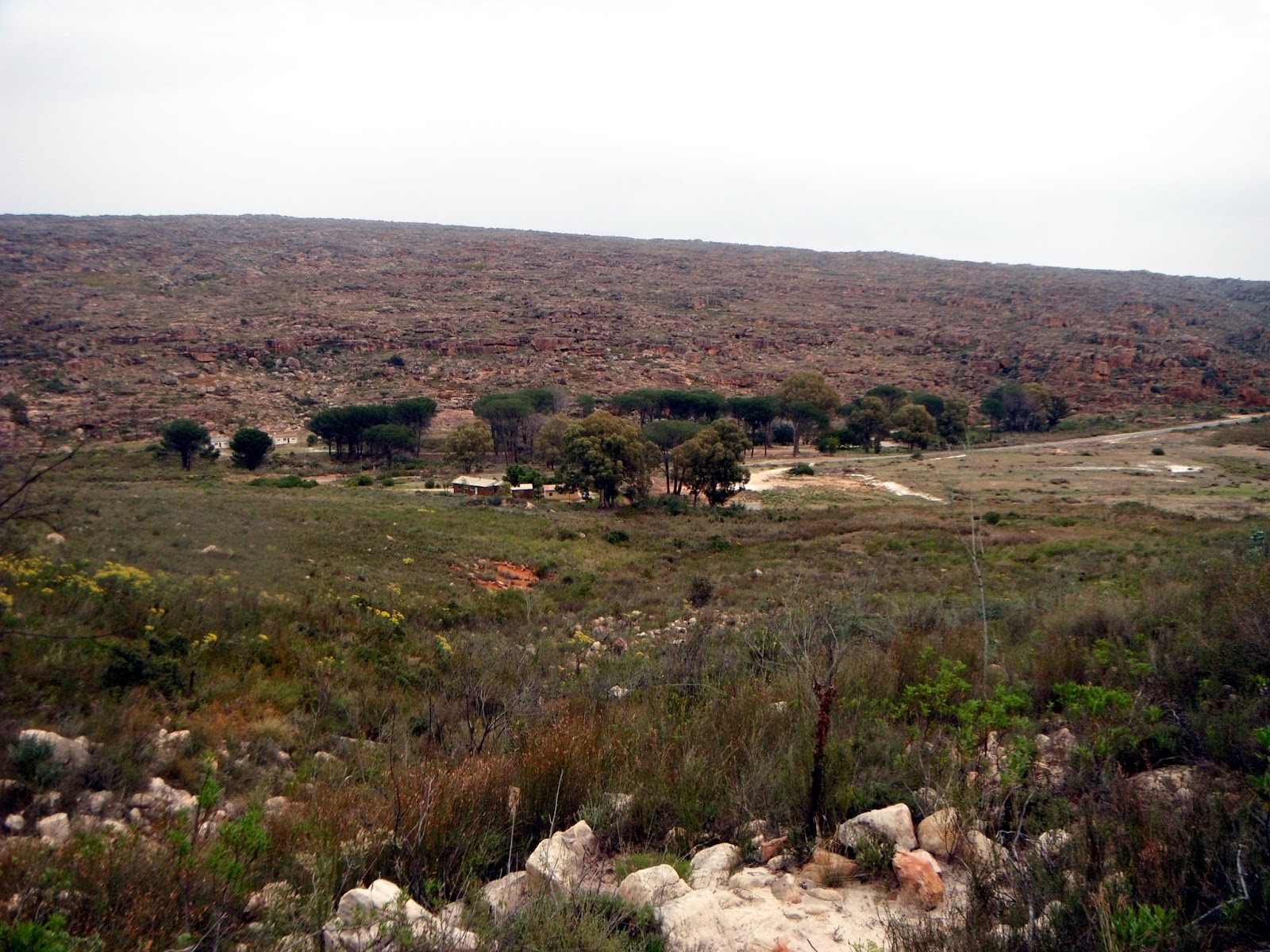
 |
| The village of Kleinvlei |
 |
| Kleinvlei se Swemgat |
Kleinvleinek : “little valley nek” [Afr]; shallow nek between Middelkop and Dassiebos, north west of the village of Kleinvlei
 |
| Klipbokkloof, with the Sugarloaf in view to the right |
 |
| Klipbokkop, from the Grootrivier side |
 |
| Klipspringer: note the rubbery hooves |
 |
| Klipboombos, west of the summit of the Pakhuis Pass |
 |
| View from the Bakleikraal side of Klipboomkamp, across the valley |
 |
| Klipfontein |
Klipfontein se Laagte : “valley of the rocky spring” [Afr]; a shallow valley that runs more-or-less from the Klipfonteinrant Pass north eastwards towards Papkuilsfontein farm [see below]
Klipfontein se Rant : “ridge of the rocky spring” [Afr]; the stony, 500m high ridge that effectively marks the ecotone or natural boundary between the Doring River Karoo and the Agter-Pakhuis. The complete and dramatic change of landscape when you drive over the ridge on the R364, in either direction, is always a surprise
 |
| Klipfonteinrant Pass |
Klipgat : “stone hole” [Afr]; a shallow, inhabitable overhanging shelter at the confluence of the Breekkrans and Groot rivers
Klipgat Trail : as above, the footpath that follows the Breekkrans River from Nuwerust to the cave
Klipgatklofie : “little stone hole ravine” [Afr]; a small ravine on the eastern slopes of Vensterberg South that runs down into the Rondegat River, just south of Algeria
 |
| Winter at the (Dwarsrivier) Kliphuis campsite, overlooked by Tafelberg |
 |
| Kliphuis campsite on the Pakhuis Pass |
 |
| Kliphuis Ridge, with Pakhuis Peak and Ribbokberg behind to the right, and Pulpit Peak behind on the left |
Kliphuiskloof : “stone house ravine” [Afr]; a small ravine on the Bakkrans reserve, that leads down to the remains of an old subsistence farm of the same name
Kliphuisrivier : “stone house river” [Afr]; river that arises near the summit of the Pakhuis Pass and flows down past the Kliphuis campsite, across to the farms on the old Klawer Road out of Clanwilliam, and eventually joins the Olifants River
Klipkop : “stone hill” [Afr]; a rocky outcrop surmounted by a cottage for hire of the same name, at Traveller’s Rest
Klipkraal se Hoog : “stone corral rise” [Afr]; a ridge on the western slopes of the Vaalheuningberg near Wupperthal which is ascended by a rough 4x4 track to a stone-walled kraal
Klipkraalkloof : “stone corral ravine” [Afr]; not related to the above at all, this is a deep ravine below Koupoort Peak that eventually joins the Clanwilliam Boskloof
Klipopmekaar : “stone(s) on top of each other” [Afr]; an old subsistence farm in the Pakhuis Mountains north of the Pakhuis Pass
Klipopmekaarrivier : as above, the river that runs from there and eventually becomes a tributary of the Brandewyn [Dril] River
 |
| Klippoort, looking south from Die Kampe |
Kliprivier : “stone river” [Afr]; a tributary of the Jan Disselsrivier that runs from south of Rocklands to where the above exits the Clanwilliam Boskloof, near the Clanwilliam Warmhoek
Kloekie se Klip : “Kloekie’s rock” [Afr]; on the Matjiesrivier-Wupperthal road, between Rietvlei and Langkloof, there is a huge boulder in the middle of the road, so that the road passes around it on both sides. Kloekie was a resident of Langkloof who had a rooibos tea land there known as ‘Kloekie se Land’, hence Kloekie se Klip. ‘Kloek’ can mean ‘bold’, ‘brave’, ‘strong’, ‘manly’ etc – seems that Kloekie was probably quite a guy
Kluitjieshoogte : “dumpling’s heights” [Afr]; presumably named after the shapes of the rocks there (or a dumpling-shaped person?); this is a nek on the only easy route between the Clanwilliam Boskloof and the Grootkloof; see Gerrit Nieuwoudt se Pad
 |
| A shyish sort of kudu bull, this one at Addo |
Koedoeskop Dam : as above, the nearby dam
Koerasieberg : “courage mountain” [Afr]; the name is a corruption of the English word ‘courage’; the origin of the name for this range of peaks north of Sneeuberg is unknown, but the rocky, broken area is an important refuge for surviving cedar trees
Koignas : “river running across” [Khoi]; see Dwarsrivier, this is the original Khoi name for the stream in the Krakadouw ravine
 |
| Kok se Poort, on the Kromrivier side with Apollo Peak in the view; note the old stile and fence |
 |
| Kok se Vlei, a sensitive marsh that you should please walk around; with the Maltese Cross in the distance |
Kolêlstasie : Unknown: we have found no explanation for this name and would love to have one: ‘-stasie’ = ‘station’ [Afr] and is common for a busstop in the region, but that cannot be the case here. Kolêlstasie is a remote, ruined subsistence farm in the Pakhuisberge north of the Pakhuis Pass, in the upper reaches of the Klipopmekaarrivier
 |
| The generous Kom Proe farmstall, on the N7 |
Kootjie Dawid se Plaat : “Kootjie Dawid’s plain or place” [Afr]; a vast area of rocky pavements, deep gullies and jumbled boulders south of the Lodge at Bushmans Kloof, and part of the Wupperthal Commonage. Kootjie Dawid was by repute a Robin Hood-like character who helped locals in distress, in particular Khoi, coloured people and freed slaves who in terms of the British Government’s dreadful ‘Master and Servants Acts’ had to live either as labourers on a white-owned farm, or on mission lands under the mission’s regulations. Dawid defied these laws for many years; his eventual fate is unknown. Local farmers put it about that Dawid was a horse-thief who enjoyed horse meat, but there is no confirmation for this scurrilous story. His story is told in novel form in ‘Jedro’s Bane’, a prize-winning youth novel by Peter Slingsby
Koperkloof : “copper ravine” [Afr]; a ravine that runs down to Keurbos farm, in the Grootkloof
Korhaanshoogte : “bustard’s heights” [Afr]; a hill of 390m west of the N7 and north of Citrusdal; also a farm nearby on the Olifants River; probably named for the southern black bustard, Afrotis afra
Korhaanshoogte Dam : as above, the nearby dam
Koro Lodge : A guest lodge at Bushmans Kloof, situated at the old subsistence farm site known as Syfer [‘syfer’=‘seep’ or ‘trickle’]. The origin of ‘koro’ is unknown; in medicine it is synonymous with ‘imaginary genital retraction syndrome’! – in Maori it means an elderly Maori man, and in Japanese it means a broad-mouthed jar ... all a trifle mind-boggling and probably incorrect ... any offers, anyone?
Kortkloof : “short ravine” [Afr]; a ravine on the western slopes of Grootberg, that runs down to the Cederberg Cottage, off Nieuwoudt’s Pass
Kosie Salomo-Voetpad : ‘Kosie Salomo footpath” [Afr]; a section of new path between Langkloof and Eselbank created for the Cederberg Heritage Route in order to avoid hiking along the Matjiesrivier-Wupperthal road; laid out by Kosie Salomo of Langkloof, and named after him
Koster se Werf : “Koster’s place” or “farmstead” [Afr]; an area just north of Algeria and next to the Clanwilliam road where Jan Koster once had his subsistence farm; he was later evicted by the Forestry Department
Kotzesberg : “Kotze’s mountain” [Afr]; a peak of 1516m south east of Sandfontein Peak, in the southern Cederberg, named for the Kotze family, the owners of Sandfontein farm
 |
| The hamlet of Kouberg, high on its ridge looking down on Wupperthal |
 |
| View across the Tra-Tra valley of the Kouberg Pass as it ascends from Wupperthal and into the distance |
Kouepoort : “cold pass” [Afr]; a narrow nek just north of Middelberg Peak, between Elandskloof and the Buffelshoek valley
 |
| Koupoort Amphitheatre |
Koupoort Peak : as above, the 1667m peak above the Amphitheatre
 |
| Rare winter waterfalls in the Kraaiberg |
 |
| Kraaiberg Pass |
Krakadouw : “stony pass” [Khoi]; the true Krakadouw is not the peak or peaks, it is the route through the ravine from the Clanwilliam Boskloof to Heuningvlei, that was once the only way to Wupperthal for all traffic whether pedestrians or wagons
 |
| The Krakadouw Pass, looking down to the Clanwilliam Boskloof |
Krakadouw South : as above; a 1723m peak south of Groot-Krakadouw, which at 1744 m is the highest of the Krakadouw peaks
Krakadouwpoort : as above; not quite as tautologous as ‘Krakadouw Pass’ because the Afrikaans ‘poort’ often only refers to the actual summit of a pass, or the gateway or nek through which the summit passes – as is the case here
Krieberg : “karee mountain” [Khoi+Afr]; the karee tree (Rhus lancea), here shortened to ‘Krie’, is common in arid parts of southern Africa; this 337m hill is north of Kriedouw
Kriedouw : “karee pass cliff” [Khoi+Afr]; an abandoned and now ruined farm east of the main Kriedouw farm
 |
| Kriedouwkrans Farm |
Kriedouwkrans Dam : as above; a large dam south of the main road as above
Kroekedam : “slum-” or “location dam” [Afr]; a popular summertime swimming hole in the Tra-Tra River, at the Wupperthal end of Sas se Kloof; the name is odd in the context, because Wupperthal is certainly neither a slum nor a location
 |
| Krom River Cave in 1959; photo by Ken Howes-Howell |
 |
| A group of climbers with the Nieuwoudt family at Kromrivier, 1959: photo by Ken Howes-Howell |
 |
| View of Kromrivier farm, from Kromrivier Pass |
Kromrivierrug : “crooked river ridge” [Afr]; the mountain ridge south of the Kromrivier valley, its highest peaks top 1600m
 |
| Part of Kroneberg |
 |
| Kroneberg se Dam: almost perennial! |
Kruger se Land : “Kruger’s land or field” [Afr]; an area once cultivated north and north west of Middelberg Hut by a subsistence farmer, Kruger, who was evicted by the Cape Government in the late 1890s
 |
| Kruidjie-roer-my-nie: so-called because the black sap will stain your fingers and clothes. A poultice of leaves of this plant was used as a remedy for snake-bite in the old days |
Kruiskloof : “across ravine” [Afr]; a ravine that is used for the mountain crossing from Algeria to the Heks River valley
 |
| Kruispad: looking across the Grootkloof to the Middelberg peaks |
Kruisrivier : as above, the river in that ravine
Kumquat : a farm west of the N7 near Citrusdal, now abandoned and a ruin, named for this species of citrus fruit
Kunje : “in the bushes, on the (river) bank” [Sanskrit]; this seems the most probable explanation for this unusual name, because it neatly fits the geography of the farm, though how a southern Cederberg farm got a Sanskrit name is not known. Other explanations seem unlikely: Kunje is a town of 542 people in Montenegro, and also a town in Angola. It is also a common Zimbabwean surname. In this instance Kunje is a farm and resort on the R303, on the southern edge of the Cederberg where the latter merges with the Koue Bokkeveld
Kunje Guest House : as above; accommodation for hire on the farm
Kunje Mountain Cottage : as above; accommodation for hire on the farm
Kweekkraal : “cultivate corral” [Afr]; 1. a citrus farm between the N7 and the Olifants River, north of Citrusdal; 2. an old subsistence farm just south of Algeria, next to the existing concrete road
Kweekkraal Primary School : as above; a prominent primary school at Kweekkraal, next to the N7 on its western side
Kweekkraal se Kop : as above; a small rise between the old subsistence farm and Algeria itself
Thank you for this extraordinary work and diligent research on the Cederberg. I thought I had a good knowledge of the area, but you make me look like a student! Well done!! I research, document and film South African mountain passes of which there are at least 15 in the Cederberg. I discovered your site whilst researching Klipfonteinrant Pass.
ReplyDeleteThanks for the compliments, Trygve, but there's a lot of stuff here that's subject to review ... so if you find other interpretations of names, please let me know!
DeleteHello, great pictures. I am planning a bouldering (climbing) trip to south africa. I have climbed in Rocklands (pakhuis pass) many times and this time was hoping to find new rocks to climb on. I have been to the Driehoek area as well. I was wondering if you knew of any areas in the southern cederbergs/driehoek area that you think might offer similar rock size to that of the pakhuis pass? thanks so much for the help!
ReplyDeletePaul -
ReplyDeleteSuggest you contact CapeNature [contacts via http://capenature.co.za/ ] - there are many areas suitable for bouldering but as this is mostly a Wilderness Area some areas are restricted - there might be opportunities at Truitjieskraal in the Matjies River Nature Reserve, but you should enquire from the management there first.
thanks a lot for the information!
ReplyDelete